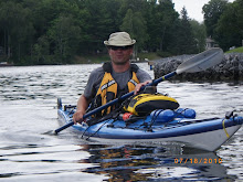
First, Georgian Bay is absolutely spectacular and excited to see every part of it and the various geographical differences and the history.
In a lot of ways, the route through Georgian Bay is much easier in terms of open water, There is only one major gap to cross and everything can be minimized by following the shoreline if need be in iffy weather conditions, I don’t have to cross a Simcoe, Balsam or a Rice Lake and be hours from shore.
However, I have no option other than to cross between Manitoulin Island and Tobermory, a distance of about 15k. Not huge but requires absolutely pristine conditions, hundreds of miles of Lake Huron on one side and open Georgian Bay on the other, don’t want to be caught out there with a storm brewing or big waves. Can be done by island hoping across which limits open water to max 7k in any one stretch.
More shipwrecks in this area than anywhere else in the Bay for a reason and is also a shipping lane, will have to watch out for freighters and the Chi-Cheemaun.
The western shore is predominately Niagara Escarpment bluffs with very little shelter from the weather, almost no islands to protect against like the 30,000 islands down the eastern shore. There is also an army base around here somewhere that does mortar practice into the lake, this is protected boundary waters and unless I want to go 5 miles out I might have to pre-arrange a cease-fire, that should be interesting.
Prevailing wind is N to NW, I plan to do the trip counter clockwise starting from the southern tip, I am hoping that I can use the 30,000 islands up the east coast to protect from weather then when coming down the western shore at least the wind will be coming from behind, that’s the plan anyway.

No comments:
Post a Comment