Long Post…
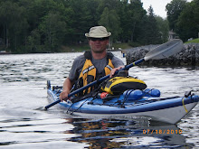
Picked up a GPS for the trip this year, the driver behind this one is simple, Trent Waterway is fairly straightforward and you can navigate without GPS (or maps for that matter) but when it comes to Georgian Bay there are so many islands that you can get lost and paddle around in circles.
I’m not a GPS guru by any stretch of the imagination but I love gadgets, thought I would do a review of my unit and provide some details on where you can save some serious cash by downloading unlocked maps.
Review broken down into 5 sections:
- Selection
- Features/Performance
- Free Maps
- Free Software
- Marine Map Frustration
Selection
When I was debating GPS for the trip last year I looked around for a handheld GPS and looked at a number of different models, kept gravitating to the Garmin Oregon 450 model, submersible, every feature imaginable and for me the selling feature, full touch screen so no buttons to worry about as there is only one for this device, power on/off. There is a baby brother version called the Dakota 10 which is a smaller version but essentially the same feature set.
All the reviews I read on both devices had two common complaints, screen was almost unreadable in direct sunlight and the compass required the devices to be laid flat for accurate readings, I passed at the time.
As with all manufacturers, they then to listen when people start complaining so Garmin released a second generation of each model, Garmin 550 and Dakota 20. Improved the screen and added an accelerometer for the compass so you no longer have to hold flat. This does require periodic calibration but it’s as simple as following directions to rotate the unit on the 3 axis, no biggie. The Garmin 550 also added a built in camera which is cool but for me, couldn’t justify the cost of the 550 as it is double the price of the Dakota. Dakota 20 it is at a cost of $319, much more reasonable. Definitely go with the 2nd generation devices if choosing the Oregon/Dakota line.
Features/Performance
I have nothing bad to say about this GPS unit, 5 stars all the way, small, rugged and waterproof (IPX7 standard) which is huge for a handheld which is going to be used on the water. It doesn’t float so make sure it’s attached otherwise, well, bye bye new GPS.
- User interface is simple and functional, works much like an iTouch/iPhone and supports multiple profiles for different settings so you can customize it the way you want, took about ½ hour to get fully comfortable with all the options and features available
- Compass screen has a dashboard so you can see other (customizable) stats such as speed, time to destination, bearing etc, and a wealth of other values, compass also includes a bearing indicator to the next waypoint so you can see how off course you may be. Trip computer has the same type of dashboard which you can configure to show the properties you want to track
- Map Navigation is very simple and you can drag around the map and zoom in/out on the touch screen, pressing screen puts a temporary place marker which you can drag around or move the map under to determine/bearing from current point, can also create a waypoint on the fly. There are other options for waypoint, track and route management and planning.
- Barometric and Altitude tracking which you can view in a plot over time and some other features worthy of mentioning just because they are there, calendar, sun/moon calendar, hunt and fish calendar, calculator, alarm clock, stop watch, area calculation and man overboard function
- Full Support for Paperless GeoCaching (which I didn’t know what it was at first) and if you are into it then you won’t be disappointed with its capabilities
- Runs off 2 AA batteries and battery life is great and better than the Oregon due to the smaller size, they say 16-20 hours but I haven’t tested that yet, had for three days now and still only half drained, hasn’t been on constantly but I have used it quite a bit
- Connects to your computer for transferring data back and forth from computer to device and vice, it has a built in 1gb flash card (950mb free) and a MicroSD slot for expansion, both are used to add new maps. HINT: If you have a Blackberry and not using the SD card in it, just flip it over to the GPS, personally best to pick up a 4GB card as the maps can be quite large
- Only comes with the World Base Map which is fairly useless, very little detail and major highways only, definitely need to add maps, City, Topographical, Marine or whatever your thing is. More on that in next section.
- Unit allows you to display multiple maps and enable/disable different maps on the flash and SD card on the fly.
I didn’t apply any scientific method to evaluating performance of the GPS, just basically did a bunch of driving around to track my route and then did the same thing while walking, consistently showed GPS accuracy to 3m which sounds good to me. I loaded the tracks into Google Earth to match up the track with an actual map and it was dead on, very impressed.
Free Maps
Adding maps can get very expensive, for instance, the Georgian Bay Marine maps (Garmin G2 Vision) are $300US and then if you want detailed city maps or topographical then you have to fork out for those as well.
Thankfully there is a site which will walk you through how to unlock maps and provides a download center for getting them. Process is very straight forward but I am technical, if you need assistance let me know and I can help you out.
Free Software
Garmin has two products, BaseMap and HomePort.
Basemap is a Windows program which allows viewing maps, loading tracks from the GPS and doing Route Plans which can be loaded back to the Unit. You can also save tracks as a GPX file which can then be loaded into Google Earth. This is a free download at Garmin but doesn’t support Blue Chart G2 Vision maps
HomePort is a Windows program which allows viewing of Marine maps, same functionality as BaseMap but isn’t free, fairly cheap at $29US, available for free at GPS Underground.
Marine Map Frustration
Complaint has nothing to do with the Dakota itself, all handheld units suffer from the same issue. Marine maps have a huge amount of detail so when you view them on the device, depending on how far in you zoom in/out the display gets very cluttered, under certain zoom levels so much so that you can’t tell land from water. Once you zoom in to where you can view/read all the detail you can’t see far on the horizon. Unit comes with different options for displaying detail but I haven’t figured out the right combination yet and if I find a solution that works well, will update this post.
Hope this helps
No comments:
Post a Comment